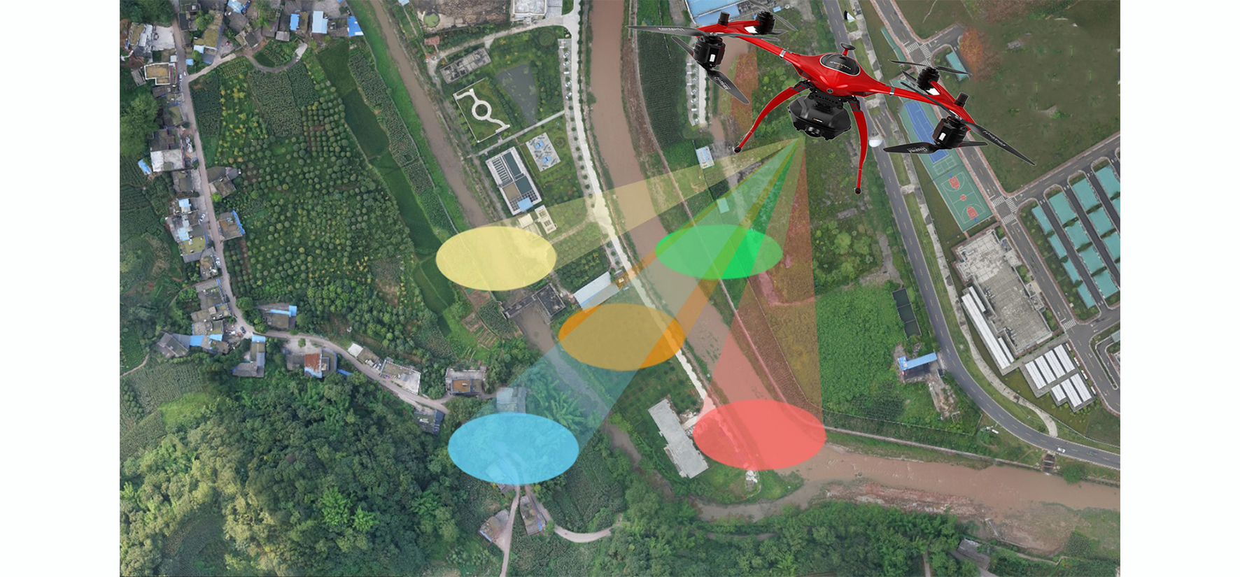
 Oblique photography technology is a high-tech developed in the field of international surveying and mapping in recent years. It has changed the limitation of aerial photography in the past that can only use a single camera to shoot the ground from a vertical angle. By mounting multiple sensors on the same flying platform, Acquire images from multiple perspectives. Oblique photography gradually replaces traditional 3D model acquisition methods with the advantages of high efficiency, high accuracy, high realism, and low cost. A city with an area of about 50 square kilometers uses oblique photography modeling technology to generate a true 3D model in about 10 days. If artificial modeling is used, 100 people are required to work for 3 months. The 3D model of oblique photography can not only bring a real and shocking visual experience to the viewer, but also because each point on the model has accurate 3D geographic coordinates, which can be measured and calculated by the user as needed. Public security and emergency counter-terrorism are promising. The fixed-wing UAV has a longer flight time and higher operating efficiency. Therefore, the fixed-wing UAV is equipped with a Oblique camera to work in a single session, which is suitable for the establishment of large-area 3D scenes. GeoRTK offers UAV 1:500 mapping solution for customized projects with our technology on UAV Based Oblique Surveying. Oblique photography technology is a high-tech developed in the field of international surveying and mapping in recent years. It has changed the limitation of aerial photography in the past that can only use a single camera to shoot the ground from a vertical angle. By mounting multiple sensors on the same flying platform, Acquire images from multiple perspectives. Oblique photography gradually replaces traditional 3D model acquisition methods with the advantages of high efficiency, high accuracy, high realism, and low cost. A city with an area of about 50 square kilometers uses oblique photography modeling technology to generate a true 3D model in about 10 days. If artificial modeling is used, 100 people are required to work for 3 months. The 3D model of oblique photography can not only bring a real and shocking visual experience to the viewer, but also because each point on the model has accurate 3D geographic coordinates, which can be measured and calculated by the user as needed. Public security and emergency counter-terrorism are promising. The fixed-wing UAV has a longer flight time and higher operating efficiency. Therefore, the fixed-wing UAV is equipped with a Oblique camera to work in a single session, which is suitable for the establishment of large-area 3D scenes. GeoRTK offers UAV 1:500 mapping solution for customized projects with our technology on UAV Based Oblique Surveying.